
The usage of real-time GIS capabilities has grown significantly over the last few years as more and more devices have started including location information with other sensor information. Naturally, the need for platforms capable of ingesting and analyzing these data has also grown. Recently we’ve seen advancements to make analysis platforms more capable and better […]
Category: MapThis

Q&A With Paul Barnes, Solution Engineer
Q: What is your job at GEO Jobe, and what does it entail? A: I am a Solution Engineer with GEO Jobe and I work on a team that specializes in customization of out-of-the-box Esri applications, Enterprise GIS deployment, and assisting clients with planning and management of their geospatial programs. I also have the opportunity […]

GEO Jobe Welcomes Dale Stevenson as Senior Project Manager
GEO Jobe is pleased to welcome Dale Stevenson as a Senior Project Manager. Previous to GEO Jobe, Dale had many contract positions including Best Buy, Wells Fargo, and Hyster Yale Group. Over his career as a project manager, he reduced the cost of tech support through the development of a knowledge base, enhanced revenue, met […]
Clean My Org 1.4.1 Update
What’s new in 1.4.1? CleanMyOrg has a brand new update available with some exciting features and improvements. In CleanMyOrg 1.4.1, we have some new scans to check proper naming conventions in service fields and some collaboration scans that can help organizations trying to sync users across collaboration groups. We also have several improvements and bug […]

Archaeologists Use Lasers To Discover A Lost City
Imagine for a moment walking through a dense and lush jungle landscape. You come across a deteriorating shell of a building long reclaimed by nature. In your mind, you can almost see how some of the other jungle formations could be other structures. You wonder if this could be more than just this simple shell of a long-forgotten […]
BackupMyOrg Update 1.1.1
BackupMyOrg 1.1.1 is now here, bringing you new features, fixes, and performance improvements to make using BackupMyOrg easier to use than ever. Some of the new features of BackupMyOrg 1.1.1 include securing client access by ArcGIS Identity, custom roles for deciding permissions for those ArcGIS identities, excluding certain tags and owners from backups by default, […]

GEO Jobe Welcomes Paul Barnes as Solution Engineer
GEO Jobe is pleased to welcome Paul Barnes as a Solution Engineer. Previous to GEO Jobe, Paul was the Principal at GC Enterprise LLC and did GIS consulting for county government and land developers, analyzed Web Map Applications for hosting clients and developed web mapping applications, and performed special geospatial requests for clients. In addition […]
Q & A With Corey Baker, Sales Representative
Q: What is your job at GEO Jobe, and what does it entail? A: Typically, it’s business development activities related to our Enterprise Team. However, as my mind tends to work, I usually find other opportunities for other teams within the company, as well. My day usually starts with a semblance of a structure, but […]
GeoAI and You: Modelling and Datasets
Last August, we covered some of the highest-level concepts about GeoAI in an attempt to demystify it. If you haven’t already, I recommend reading that article before continuing. If you already have, welcome to part two of the series! We’re happy to have you. Today, we’re going to be digging into what goes on “under […]
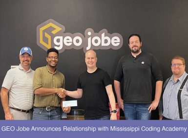
GEO Jobe Announces Relationship with Mississippi Coding Academy
GEO Jobe is pleased to announce a relationship with Mississippi Coding Academy. This investment on behalf of GEO Jobe symbolizes the beginning of a mutually beneficial relationship to not only GEO Jobe, but the future of graduating students from the MS Coding Academy. GEO Jobe and the Mississippi Coding Academy want to equip students with […]